You'll be glad if your GPS is better than this service that Ed Lomas, a friend from 6th grade, sent me.
--------
Quality Mapping of the Day
1. Go to http://mappoint.msn.com/DirectionsFind.aspx
2. In the Start section, select "Norway" from the listbox and enter
"Haugesund" into the "City" field
3. In the End section, select "Norway" from the listbox and enter
"Trondheim" into the "City" field
4. Click on "Get Directions" ...
5. Laugh, Snicker (Delete as appropriate)
6. Back up. Try "shortest". Try "reverse".
Tuesday, February 15, 2005
Sunday, February 13, 2005
A Benefit of a Short Hop
If you read any of my stories about the West Coast Road Trip, you'll see what a time I had using a GPS instead of map. It was definitely a love-hate relationship for a while. Nevertheless, once you have a GPS, you won't want to part with it or go anywhere without it.
With time, you also learn how to use your GPS with more skill.
Still, one of the weak links in the Garmin GPS is it's power cord. More than one has had to be replaced due to the connector coming apart. It is designed to hold a fuse. Part of it can be unscrewed so that the fuse can be replaced. Along with the fuse, inside the connector, is a small spring that holds the fuse against a plunger that pokes out of the connector and makes contact with the cigarette-lighter adapter.
Well, the screw bit is known to come unscrewed all by itself. More than once I've found myself returning to previous locations and searching for parts of this connector or the spring. Today, it was a good thing I had only driven a few blocks to my friend, Mindy's and back.
Arriving at her house, I took off the GPS and removed the cord going to the power adapter. I pulled the connector out of the cigarette-lighter adapter and put the coiled cords into the bike's rear box. After visiting with Mindy, I got on the bike and rode home. It was at home, when I went to remove the cords from the box, that I saw the connector had come apart again When I picked it up, the fuse fell out of the connector into my hand.
A neighbor interupted me, and a moment later I began to look for the screw and plunger. They weren't to be found in the box, amid the clothing that had also been in the box, or on the ground. Nuts.
I took things inside then rode the bike back to Mindy's. The screw part was right on the ground where I had parked the bike. Thirty seconds later, I found the plunger. But fifteen minutes of searching the pavement and I had not found the spring. I kept thinking about where I had found what parts of the connector and how the connector went together to see if I could get some insight into what direction the spring might have gone as I pulled the connector out of the adapter.
Then it dawned on me: The spring fit under the fuse. It could not have come out of the connector before the fuse did, and the fuse had been found in the box at my place with the connector.
Back to my place. I parked a few feet away from where I had previously parked, backed to the curb. The spring was not anywhere on the street. That would mean I would have to look amid the grass and the leaves. Looking at where the back of the box hung over the curb, I chose the same area behind where I had parked, previously. A few seconds later something silver glinted from between two leaves, and I had what I needed to put the connector back together.
The good news is that Mindy's was only two miles away not more.
Saturday, February 12, 2005
2005 First Ride
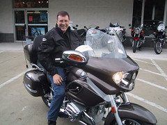
The bike has been in the shop getting repairs and waiting for parts since before Christmas. There have been a few days with ride-able weather in that time, but better days are still ahead of us. Nevertheless, the bike was ready, the sky was blue, roads have been free of ice for many days; I was ready.
For more than 20 years, I've met with a group of Episcopalian Franciscans. Thursday, I had an e-mail reminding me that they were meeting this morning. One of them, Ed Schneider, lives in Baltimore. Another couple of e-mails later, he agreed to pick me up on his way down to the meeting place at Catholic University. After the meeting, we could ride together back towards Baltimore and he would drop me off at Bob's BMW.
Given St. Francis's love for the outdoors, animals, and preference for seeking inspiration while alone in nature, this was an excellent way to preface a return to riding a BMW motorcycle. While BMW riders occasionally gather for rides, for most of us, the pleasure is in our solitary explorations. Riding is something very akin to the contemplative life.
The morning went well. We began with coffee, and caught up with each other. Pam had word of Gary, who had been meeting with the group a couple of years back, and is now retired to a small apartment in Greenwich Village, NY. We heard about work being done in Haiti and the idea of donating funds to purchase an ox and a plow that the church there could use for a coop arrangement supporting subsistence farmers. We talked about having a retreat in the fall. Perhaps it will be someplace that will present an opportunity for a good motorcycle ride to-and-from. We then turned to study, reviewing several books that we might work on together, but agreeing to focus on the Franciscan daily principles http://www.tssf.org/princip.htm.
After Morning Prayer, we conversed a bit about the warlike aspects of some readings, especially the Psalms.
Finally, it was time for goodbyes. Ed and I headed north to Jessup and Bob's BMW.
Dropping me off, Ed made a fast exit. He did not wish to catch the motorcycle bug, I think.
The folks in the service department make the business of being without your motorcycle while it's being fixed as painless as it's going to be. The pleasure of visiting with John & Daryl, the discussions of world events as well as various routes to get somewhere, or the technical aspects of the motorcycle seem to be a theology of their own. The conversation seems to be exercising the same muscles in my brain as conversations earlier in the day.
Bob wasn't there. He was at a motorcycle show at the Timonium Fair Grounds. Five dollar discounts coupons were available at the counter in the Parts Department. It made sense to make this a destination, being so close.
I checked the turn signals to make sure they worked. I opened the gas tank, jiggled the bike side-to-side a bit, and learned that it would need fuel soon. Finally, I began the exercise of putting on riding pants, zipping up the jacket, adding a neck warmer and helmet liner over my head, then removing my glasses to don the helmet and eventually getting the glasses back on correctly, hooked over my ears inside the helmet. Next, the helmet straps, then the gloves, then... oh rats, the key is in my pocket so a glove comes back off. I find the key put it in the ignition, put the glove back on, then turn the key to on, make sure the neutral light is lit, and press the starter button.
The starter seems to hesitate. It tells me that one of these days I'll need a new battery. Hopefully, with a little riding it will start faster, next time.
I adjust the mirrors then back out and head for the road. A parking lot nearby was my first stop. I would pull in and do a few figure-eights to get the feel of the bike again. That done, I headed West on Guilford Road toward Highway One. I had been thinking about food when we left Catholic University, now hunger was occasionally reminding me of its interest. I thought I might ride up Highway One to Daniel's: a kind of biker bar that serves booze in a drive-in fashion--one of two places in the country grandfathered in when the laws changed. Daniels has a reasonably priced menu.
At the light, I pulled up behind a pickup and put on the blinker to turn right. Waiting at the intersection, I noticed that Guilford continued and I had never followed it West from there. I knew that Guilford Rd crossed 108 quite a ways west. Perhaps I would follow it for a bit.
Indeed it remained a pleasant two-lane road for some distance. Then it came to a "T" and a sign told me the way to Route 32. I didn't want to take Route 32, it was too well known, already. I stopped, dug the GPS out of my back pack, mounted it, hooked up the power cord to the BMW's auxiliary 12-volt socket, and studied the GPS map display. Guilford Road showed up again further West, and then disappeared again. Probably, it was the route west before 32 was built. The academic exercise of searching out all of its segments did not appeal to me.
"Might just as well set a course for the bike show in Timonium," I figured. Still at the curb, I zoomed the map out to the 30-mile scale, scrolled until the 83/695 intersection was centered, and then zoomed back in. John, in the service department had told me the fairground was between the first and the second exit off of 83. I zoomed in and put the cursor on the road that paralleled 83, to the East, between the first and second exits and pressed the "Find" button. Pressing "Enter" I selected "Points of Interest," then pressed "Enter" to select "Near Map Pointer." It gave me a choice of a number of categories of "Points of Interest." A Fairground would be under attractions. The rocker switch moved the selection bar down to "Attractions," I pressed "Enter," then pressed "Enter" again to select "All Types." The GPS started working.
It kept working....
"Hmm, must be a long list."
It was. When the list popped up, all I could see was churches. Interesting that Garmin thinks of churches as attractions…. I backed out of the list by pressing "Quit" once, and then chose a specific category of "Attractions." "Amusement/Theme Park" might help narrow it down.
More waiting, then a list appeared that, scroll as I might, had nothing about fairgrounds. AMF Timonium Bowling Alley showed up, however. I figured Timonium anything would get me close enough, so selected it. The GPS asked me whether I wanted to see a map or "Goto" it. I rockered over to "Goto," pressed "Enter" and it asked me: "Faster Time, Shorter Distance, or Off Road?" I chose "Shorter Distance," and it began calculating.
When it stopped, I put on the blinker, waited for a couple of cars to pass, then moved into the roa. Soon I was driving up Broken Land Parkway. GPS directed a right turn onto Route 29 North. I took it then realized I needed another adjustment, so set the cruise control, pressed the GPS's "Menu" button twice, bringing up the "Main Menu," rockered down to "Setup," and pressed "Enter." Pressing the rocker switch to the right, I moved from "System" past "Time" and "Guidance" to "Routing." Pressing the rocker switch up, once took the selection to the bottom of the screen where there were three check boxes under the word "Avoid." The first check-box was checked so that the GPS would not direct me to make U-Turns. I rockered to the right pressing Enter to put a check mark in the two empty boxes for "Toll Road" and "Highways." Pressing "Quit" two times took me back to the map. Pressing "Menu" once, gave me the choice of "Recalculate." I chose it and pressed "Enter" and th GPS started thinking again. Now, I didn't have to worry about missing more interesting roads.
The route left me on 29 until the interchange with 40. There I followed instructions going Northeast on 40 to Rogers Ave which took me north through housing to Old Frederick Road. This was pleasant. A few hills, a few turns, then a single-lane bridge and onto Johnycake Road. A turn onto Fairbrook then Greengage, and then a right onto Security Blvd. A Shell station on the right beckoned. As I pulled up, I saw that my low-fuel light was on. Good to know that it still worked. A sign at the station offered 10% discounts to government employees who presented their identification tags. A funny thing to see on a street named "Security," it seemed to me. I hoped some government employees had the sense not take up that offer.
Filled up, I waited for a break in traffic. GPS wanted me to make a left from the left-most lane in half a block. I waited and made the turn, finding that I was still a bit rusty a slow speeds. The turn put me on North Rolling Road. 35 mph almost felt fast after the last few miles. Traffic was light, the neighborhood was pleasant, and I looked down to see I was going past my turn. It probably wouldn't matter, but I had no traffic so a U-turn would work. It did, but the road was narrow enough to remind me that I was new at riding, again.
Backtracking a few yards, I turned onto Milford Mill Road. Milford shortly intersected with 26. I smelled food and was again tempted. No doubt there would be a tavern or two to visit, nearby as well.
"Next time," I told myself.
Through the intersection, and on past the Medford Mill Swim club and under Highway 95 I went. So nice not to be "on" 95, I felt. Next a turn onto Sudbrook where I discovered one of the treats of exploring off the highway. A grand house with a well manicured lawn filled a turn in the road. I would have to bring lady-friends here to see this house. Up the road I saw others, but as I drew abreast I almost fell off the bike trying to look left and right at the amazing things they had done with coloring the houses. Sudbrook turned into Old Court House Road. Old Court House Road made a turn right that I missed. I made the next right onto Terrapin Place hoping I would be able to reconnect with the route, and the GPS started automatically recalculating. It as an interesting neighborhood of one-level homes such as I often saw in Hawaii, where basements were not popular. Kids waved to me, pleasantly. I waved back.
The GPS beeped. It had a route and I followed it into... Woops, did that sign say private property? Did it mean the property or the road? I could see a street up ahead, but there was an electric gate to get through to get to it. I slowed to make a U-turn and a red car pulled turned onto the street ahead of me and approached the gate. They put in a code. I sped up and scooted through right behind them. Good Grief. Imagine these folks not wanting to share a road with their neighbors. I hoped their property values would fall when buyers figured that out. Who wants to live in an unfriendly neighborhood?
I was back on Old Court Road. It ran on for some time then joined Joppa Road, a road I remember riding before. Soon I as in housing, and followed neighborhood streets to Timonium.
Subscribe to:
Posts (Atom)