2003-07-01
Pete and I discussed where to go for breakfast before we left camp. It was agreed that we would travel together as far as Dubuque. We used the Garmin V GPS to find a place to eat in Dubuque. I scrolled the arrow to downtown Dubuque, pressed the find button and indicated that I wanted restaurants closest to the arrow point. Dottie's Cafe sounded good so I told the GPS to guide us there.
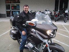
I followed Pete out of the campsite, then he pulled over. He suggested that as I had the GPS and therefore knew where we were going it would make sense that I lead. This was kind of a first for me, as I generally am content, in a group, to follow. The big question was as to how fast to drive on the empty morning roads, but I soon could tell by the distance he followed that our comfort zones were about the same.
The GPS did a good job of guiding us downtown, up the appropriate streets and back on the correct one-way street. Soon it said "arriving at Dottie's Cafe," but I saw no cafe. I pulled up at a curb and Pete pulled along side.
"We're suppose to be there," I said.
"Hmmm. Would that be it?" He pointed at a sign at the end of the next block.
I looked back at the GPS. Sure enough it said, "Arriving at Dotie's Cafe." Then at the bottom of the screen it said "280 feet."
We motored to the next block, parked, and went inside. With Pete in full leathers, I felt a bit like I was in a Western movie. As we stepped into Dottie's, the sensation continued as the restaurant full of regular customers in what appeared to be their sunday/go-to-meeting best clothes fell completely silent. The place was packed and nobody appeared to be under 60. Fortunately, there was a counter with empty stools. Once we sat down and began to talk between ourselves and with the waitress the room relaxed a little. By the time we were done eating we had been pretty much forgotten. Before leaving, Pete insisted that bikers were suppose to tip well, and so we did.
Outside, we worked out Pete's route to the freeway and said our goodbye's. It felt a bit sad to be parting after so brief a ride together. Another Western story, I suppose.
My next mission was to find a place to send a fax. My old boss at the Peace Corps, LaVerne, was waiting for it. Eventually I found CopyWorks out on Highway 20. They let me camp out, print the documents, fax them, and they let me download the maps to my GPS using one of their desks. LaVerne later said what a surprise it was since she had lived in Dubuque, between stints in Washington, and had frequently used the very same service!
For some reason, I had it in my mind that I wanted to visit Madison, Wisconsin on this trip. Years ago, I had met a woman in Franklyn's, which use to be my favorite Washington, DC coffee shop. She had sold me on a visit to Madison, someday.
I began to follow the route. It took me back through Dubuque, but because of the "avoid freeways" setting being back on took me through some of the tougher parts of town and across the 16th Street bridge into Wisconsin. Then the GPS stopped working. It gave a message about lost reception. Probably the failure was due to vibrations and shock. I did the reset process again, waited until it recalculated the route and headed up highway 151. At the Kaiser turnoff, it failed again. I spent some time, parked in a farmer's driveway, trying to sort things out. Once it was working, I was back on 151 and off again.
At the next exit it directed me off of the highway through Kieler and onto local roads. These proved to be a bit of fun. The GPS sent me on one local road and then another. In Cuba City, I got gas and again played with the GPS. I began to think more about how to get the GPS mounted on the tank bag and off of the handlebar. I managed to move the handlebar mount from the handlebar to the handle of my tank bag, but I could tell that it wouldn't do for long. A broom leaning against the wall of the garage gave me the beginning of an idea, but for now it was time to move on.
The route continued East to Avon and Darlington. Darlington was a real gem of a town that I would never have seen had I stayed on the freeways. Its clean Main Street offered two hardware stores and a corner tavern with a flow of lunchtime customers that promised good food. I cruised down Main Street then doubled back to park in front of the tavern.
Attending to business first, I visited the hardware store and bought a dowel. They agreed to cut a five inch piece out of it and drill a 1/4" hole in each end. Back at the bike, I used tie wraps that came with the GPS threaded through the holes in each end of the dowel to hold the dowel to loops at the front of my tank bag. Next, I moved the handlebar mount to the dowel. It almost fit. Using my small Swiss army knife, I cut a couple rectangles of cardboard from the back of my notebook and used them as shims. Problem solved!
After a hamburger and fries at the tavern I was on my way again. The GPS seemed to be working. It looked like it belonged at the top of the bag. Certainly, it was much easier to read.
Highway 23 took me North to Mineral Point. I was about to pass quickly through the town when something prompted me to turn back and navigate up High Street where I found a venerable-looking Trinity Episcopal Church, a couple of galleries, a bed and breakfast inn, inviting coffee shops, and restaurants before returning to my route.
Continuing North out of town, I rode to US 151 which skirted Dodgeville then turned East. The road and the scenery became increasingly congested until a half-hour later when I found myself entering Madison. This was a lengthy ride Eastward which, after remembering the fight on Highway 30 to get West the day before, did not entirely please me. Probably I needed to take another break about then and get a long drink of cold water.
At about the point where the GPS should have given me turn instructions I looked down and it had completely shut itself off. Instead of being guided to Nakoma or Midvale Streets, and into the heart of Madison, I found myself going east in heavy traffic on US 12. It was about 3 in the afternoon. The sun had been making itself known all day, but in the increasingly congested traffic the heat became oppressive. I turned the power back on, and the GPS started recalculating the route. This could take a minute or three. Since I knew I eventually wanted to go North after visiting Madison, I turned North on US 51 and began looking for a gas station where I might regroup. I found one just off the Cottage Grove exit, but was none too pleased at how difficult the folks in Wisconsin were making it for lost motorcyclists to get turned around. No U-turn signs probably had a purpose but were getting in my way and angered me. It was definitely time for a break.
An easy-going attendant at DB's Service Center helped me chill out. The air conditioning felt good. As he talked I watched the firemen across the street working on their truck and its gear. One of them was a young woman. She was in shape but a little short and struggled to get a hose into its place on the truck. I wolfed down a bottle of Gatorade, marveling that the firemen didn't seem more worried about the heat.
I excused myself and started looking at the new GPS problem. I soon realized that the GPS had quit because its batteries were dead and because the connection to the BMW's 12 volt DC power had come loose. The BMW has two 12 volt connections. You can hook up a pigtail to one of these with a cigarette lighter adapter on the other end. Then, anything you can power from a cigarette lighter can be connected to the pigtail. The problem seemed to be that the GPS plug was being pulled out of the cigarette lighter adapter as I rode. This connector rode between me and the gas tank and my movement could tug it loose. Normally, when it loses power in this way, it gives a message and you can press a button to remain on battery power. Since the batteries inside the GPS were dead, it instead had to shut off. I bought new batteries and made a mental note to check their level on the setup menu of the GPS more frequently.
The traffic had been so maddening that when I found that I was already beyond the parts of Madison that I wanted to see I decided to just keep going. I felt it was time to get myself North to Highway 2. In hindsight, this might have been a good place to spend the night. I could have seen what I wanted to see, got some rest, and continued in a better frame of mind. On the other hand, I still had six hours of daylight and there was a tavern I had been looking at on the Map that seemed so inviting: The Iron Horse in Hurley. I had no way of knowing that this destination would prove to be such a disappointment. It sounded like such a good stop for touring motorcyclist. Quite possibly, a riding partner would have helped me think better of this.
The next six hours I moved North first on I-39 then on US 51. The scenery became more rural. I made frequent stops at rest stops and even pulled over at one underpass to admire the surrounding country. I was glad to be away from the city. In the open country I managed to average about 75 mph. When towns like Wausau intervened, I slowed to about 60. Highway 51 took me through wooded country. I felt I could be riding through Germany. The resorts around Minocqua Lake were particularly inviting, and I began to suspect that I would not find better where I was going. Nevertheless, there was an hour and a half of daylight and I didn't expect to do much but sleep when I got where I was going, anyway.
The highway began to weave between numerous lakes: Manitowish Lake, Spider Lake.... Then the GPS found a secondary route and I turned up a county road, CR-K. The road was narrow and I had to slow to about 35 as it wound around Rest Lake. At the top of the lake the road forked. The part that went straight was CR-W. I stopped for a moment to make sure of the choice then proceeded on CR-W. Still, it was not a road for racing. Deer could show up anytime. There had not been a lot of space between the narrow road and the forest, but the new rode opened up a bit. A mile later I realized I could speed up a bit, but decided I needed to stop and zip up my jacket, first.
Fifty miles an hour seemed a comfortable speed. Where the road opened up more I could go a bit faster. It also helped when I was going North, passing Turtle Lake, rather than riding West into the setting sun. Above Turtle Lake the road curved East before my turn onto CR-o going North, again. Five minutes later I pass a sign welcoming me to the UP. I turned around and went back to read it again: "Welcome to the UP, eh?" Then it cautioned, "Slow down after dark, don't drink & drive, and be careful crossing."
"Crossing what?" I wondered.
There after the road was CR-519. It ran for a ways North West, making me shade my eyes from the sun, then bended around the end of Chaney Lake and ran North East then North along the Western side of the lake. Fifteen miles later I approached Wakefield where I knew I would meet up with US 2, my intended route Westward. Seeing a home with smoke from a wood burning stove, I pulled off for a moment on Olsen Road for a closer look. People were walking between their home and a shed. I was so close that I felt I was intruding. With a nod and a wave, I returned to the road and headed into Wakefield.
Wakefield seemed the kind of small town that I would enjoy living in, having spent my early years in similar small town. It was just big enough to serve the farmers in the surrounding country, not big enough for its own police department or a mayor, I presumed.
The road met US 2 near a lake. I turned left and pulled into a gas station on the corner. Restrooms were outside. People, in the Winter, would not have to track through the store to get to them. I knew Winter there was significant. The guys gathered by their pickup trucks outside the restroom were talking about their Winter jobs as snow plow drivers. They looked like kind of robust, jolly men you would expect to find behind the steeringwheels of snowplows. Such jobs afforded them a way to be outdoors. Somehow they would make it through the Summer weather.
Across the street was Club 28. There were cars in its parking lot. It was inviting. Perhaps I was taking the adage that you'll never reach your destination if you stop at every tavern to an extreme, but I would wait until the next town and see what the Iron Horse offered.
Back on the road, it was nearly dark. US 2 took me through Verona and Bessemer. Then to the connected towns of IronWood and Hurley. It began to dawn on me that the Iron Horse Inn, in Ironwood might have nothing to do with biking. Sure enough. It was nothing more than a compact corner bar. No doubt there would be local color to be found inside, but not bikers. I saw bikes parked at the other end of the block, in front of The Munch.
It made sense to get a room before coming back for dinner. I found a room that cost too much at the Days Inn. I didn't have the steam to look further. I took a short bath, changed into a fresh shirt and went back to the Munch. It turned out to be a bargain for dinner and a lively place full of old and young people, alike. I ordered an O'Doul's, an alcohol-free brew, and a plateful of taco's. The tab came to $10.00.
Next to me were young men. Across the bar I watched three young ladies. They seemed barely old enough to be drinking. One of the ladies came to our side of the bar and stood behind me. About the same time, I realized that I would be more comfortable standing up than sitting on a bar stool, after riding all day. Pushing the stool back, it occurred to me to offer it and she accepted. As I continued eating, it dawned on me that she had been standing there talking to the young men for some time and perhaps one of them should have thought to offer her a seat first. The left by the front door. I left by a side door I had seen others using that I realized led to where my bike was parked on the side street. The young kids passed on their way to a Jeep parked behind the club. As I was climbing on my bike, the young woman turned and said good-bye. Her courtesy felt surprisingly good and I rode away feeling uneasy about her limited choices for boy friends and hoping that she would end up happy.
Returning to the Days Inn, I parked next to a couple of Honda Goldwings that were pulling trailers. I went about cleaning the bike and putting on it's cover. One of the Goldwing owners came out an rummaged in his trailer. I asked him if he knew anything about places to eat breakfast. He wasn't in a mood to talk. His hands emerged from the trailer holding a dripping bottle of champagne. He could not have cared less about breakfast, at the moment. As he walked off, I considered the possible differences in our approach to and goals in touring and in life. For some a motorcycle is just another dating game, another toy among an estate of toys. I think such people are really slaves to the demands of their money and power. Riding a big bike gives them the illusion of freedom and adventure. For some, the motorcycle is truly an escape to nature although nature has its own rigors and demands. Yet for others, the motorcycle is a symbol of the freedom they desire. Like the man with the kids--not all responsibility is bad. Yet, to be successful in bearing up under ones responsibilities there is nothing like having a little fun. A motorcycle doesn't have to be real fancy to be a whole lot of fun.
Another reoccurring problem of the trip was the way my cell phone kept running down. When I roamed, it seemed to use batteries more than normal. I could charge it from the bike in the same way that the GPS could be hooked up, using the cigarette lighter adapter on the pigtail, when it was not being used for the GPS. So, as I cleaned the bike, the cell phone sat on the seat charging. At some point I bumped the cord and heard the phone beep like it does when it goes on the charger.
"Weird," I thought. "Wasn't it already on the charger?"
Yes, the cord was plugged firmly into the cigarette lighter adapter and the green LED on the cord plug was lit. Immediately, this told me there was an intermittent short in the pigtail somewhere between the cigarette lighter adapter and the connector that plugs into the bike's 12-volt accessory socket. I wiggled the pig tail and the phone, sure enough started beeping. It didn't take long to figure out that the short was in the connector that plugged into the bike.
I took the pig tail with me to the hotel room for further investigation in the light. I did not have high hopes. Despite years of training as an electronics technician, in the Navy, the fixes for the simplest of devices often eluded me. Often they are not designed to be fixed. My first clue that this might be different was the discovery of a screw that held the connector together. The Swiss army knife on my key chain was all I needed to open up the connector. Inside, I expected to see something that needed to be soldered, but was again very pleased to see that the leads were instead connected by small screw clamps and that one had come loose. Within minutes the loose lead was re-clamped and problem was solved.
I began the process of loading maps for the next day into the GPS; setting it to automatically turn off when done. Then, I went to bed with a sense of optimism. Things were improving.
All Material Copyrighted by © J B. Fields 2004 unless credited otherwise
Subscribe to:
Post Comments (Atom)
No comments:
Post a Comment